
Photo: Bismarck National Weather Service
JAMESTOWN, N.D. (NewsDakota.com) – It’s still early, but forecasters say the first winter storm of the season can be expected Thursday into Friday this week.
Because it’s early, Ag Central Meteorologist Mick Kjar says things can change. But for now, it appears snow is likely in our area.
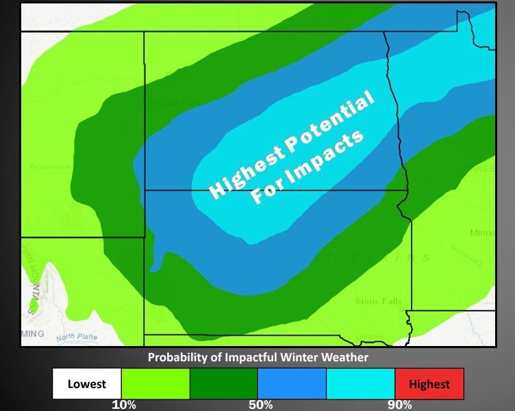
The National Weather Service reports highest potential for impacts extends from south central into eastern North Dakota. While details are likely to change, now is the time to start preparing.
Kjar says it’s likely this will be the first widespread snow we’ll experience.
Kjar adds that it’s a Colorado low that will track across Eastern South Dakota and Southern Minnesota.
“With these systems, the most significant snow is to the Northwest of the center of the low,” he explained. “How far south the system will track remains uncertain.”