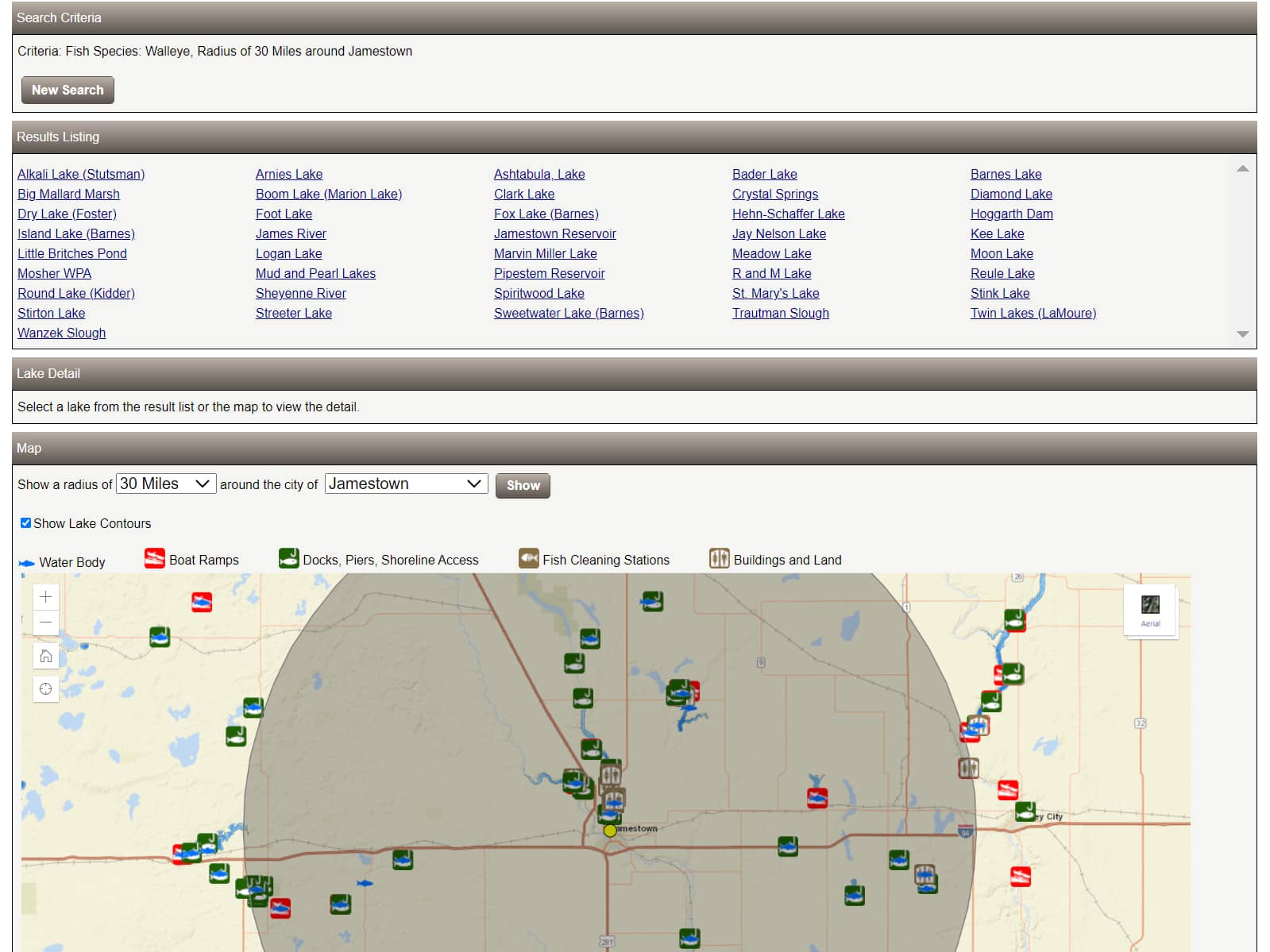
This screenshot of the updated NDG&F Where to Fish page results shows those waters on a map within 30 miles of Jamestown containing fishable walleye populations, generated by the new search features recently created by the agency. Simonson Image from NDG&F webpage.
By Nick Simonson
To help anglers better connect with an array of fisheries information complied by the North Dakota Game & Fish Department (NDG&F), the agency recently upgraded the search functions associated with its “Where to Fish” page.
Where previously the landing page provided separate links to various pages and files containing information, it now allows anglers to find data for a lake all in one place, from locating waters near a certain city or town, to reviewing stocking reports and survey results. By typing in a species, lake or municipality, anglers bring all that information within a click, according to Brian Hosek, NDG&F Business Operations Manager.
“In the past we’ve had a tremendous amount of content including data, mapping tools, and reports available to anglers throughout the website; just a lot of content all over. Our staff really did a great job of improving the navigation in bringing all of this content together in this Where to Fish concept and updating this page on our website,” Hosek relates.
The new Where to Fish landing page now allows anglers to search for fishing waters based on four tiers. If anglers know the name of the lake, they can simply type it into the “Select by Lake Name” search bar, which will bring up all lakes that contain that name or those characters entered.
For example, searching for “Nelson Lake” will yield Jay Nelson Lake in Stutsman County, Nelson Lake in Oliver County and Nelson Lake in Sargeant County, from there, the user can simply click on the lake name for a link to all pertinent information including restrictions on speed or baitfish usage, contour maps, directions to the water, access points, fish stocking reports, boat ramps and their usability status, and results from recent surveys conducted by the agency.
Additionally, if anglers are seeking out a specific species, such as rainbow trout, white bass or black crappies, a second search tier allows them to find waters containing those fish. The results are displayed in linked lake names and by lake icons on a map of the state where those fish can be found. By clicking on the name of the lake or its icon, anglers are taken to that lake information page to confirm the request and inspect the catch rate and other information related to those species and others in the water body. This particular search option, Hosek suggests, will help anglers utilize those less-pursued species in the state.
“It allows us to promote some of the other fishing opportunities and perhaps looking at some of the less sought-after species, with bass, bluegill, crappie, trout, and catfish-type opportunities. It lets folks navigate that to search some of those fishing waters,” Hosek explains, adding that the species searchability function is an offshoot of the agency’s increased recruit, retain and reactivate (R3) efforts in recent months, highlighting these abundant and often easier-to-catch species.
Additionally, anglers can search for waters within certain distances from hundreds of towns and cities in the Peace Garden State and set a radius to find out what fishing opportunities lie within a quick drive to a lake or river. In conjunction with that, searchers can select shoreline features such as fishing piers and handicap accessible angling areas along with boat ramps and fish-cleaning facilities. All four tiers can be combined for a very specific search, or users can let it ride and search by just species or distance from their hometown to find opportunities on the map tailored to what they want to get out of their angling experience.
The upgraded Where to Fish page can be found at: gfappspublic.nd.gov/wheretofish/Search.aspx
