
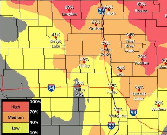
Photo: Grand Forks National Weather Service
JAMESTOWN, N.D. (NewsDakota.com) – Beginning late Thursday into Friday, the first snowfall accumulation is expected to hit parts of Central North Dakota with heavier snow expected in the Northeast part of the state.
Ag Central Meteorologist Mick Kjar says over the next three days starting today (Wednesday), there will be three separate weather events starting with cold rain.
Kjar says snow amounts will vary across North Dakota.
Heavier snow is expected along the Canadian Border eastward to the Lake of the Woods Region, where some could see upwards of 6 inches or more.
Elsewhere, residents can generally expect a widespread area of 1 to 3 inches, with pockets of 4 inches or more. Northwest winds will be gusty with 40 mph gusts or slightly higher. The primary impacts will be the Thursday evening and Friday morning commutes.