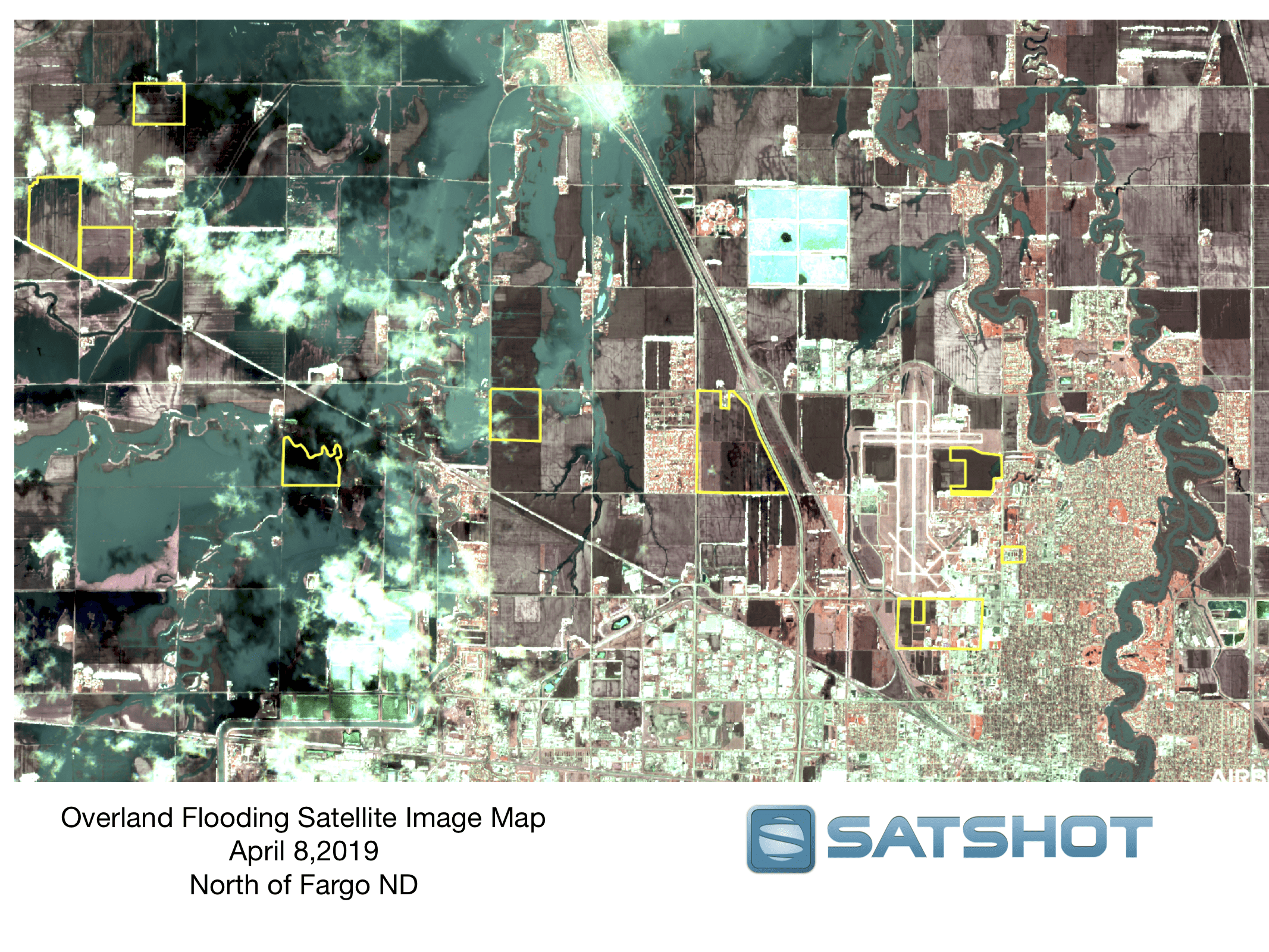
FARGO, N.D. (NewsDakota.com) – A satellite image from Monday (4/8) shows the extensive overland flooding just north of Fargo. The water covered a large area from just north of Mapleton to the Harwood area. A special thank you to Satshot for the image. You can find out more about their company at Satshot.com.